
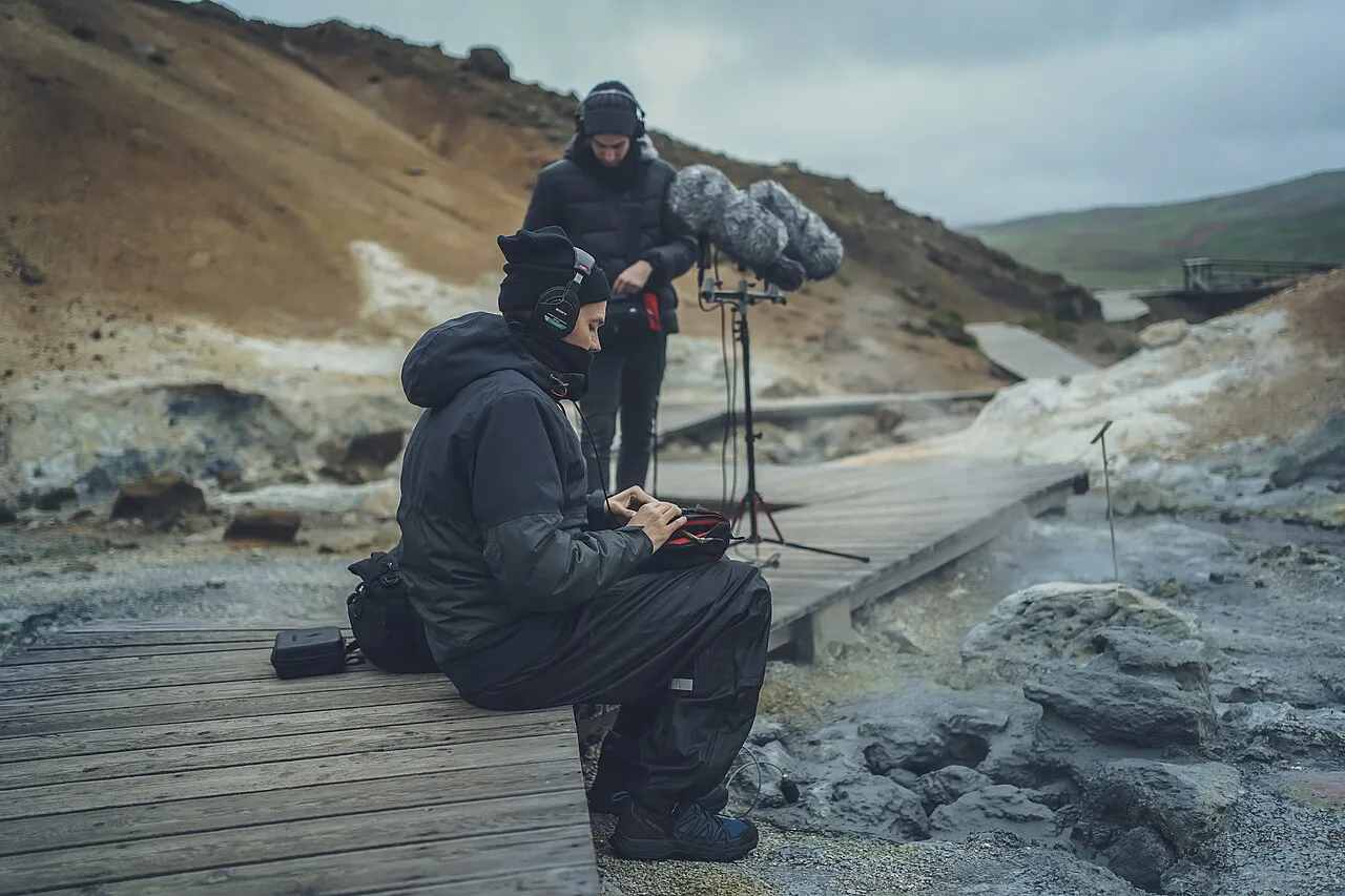
Last updated November 2026: Krýsuvík (often searched as krysuvik) is a high-temperature geothermal field on the Reykjanes Peninsula, and its Seltún boardwalk is the part most visitors see. Allow about 60 minutes, expect free entry, and plan a short drive from Reykjavík. It suits anyone who wants a steaming, sulfur-scented stop added to a Reykjanes day.
Featured image: Free To Use Sounds, CC BY-SA 4.0, via Wikimedia Commons.
Krýsuvík at a glance
Krýsuvík is a geothermal area on the Reykjanes Peninsula, and Seltún is its main visitor section. It is normally reached on Route 42, which branches off Route 41. Route 43 leads to Grindavík, so do not mix the two up when you set your navigation. Drive time from Reykjavík is reported at roughly 30 to 45 minutes, and live traffic on your map app will give the best estimate. This stop is one of the easier geothermal visits in our guide to 10 Volcanoes in Iceland: Which to Visit and How.
- Entry: free, and listed as open 24 hours a day.
- Time needed: about 60 minutes at Seltún.
- Terrain: a short, flat boardwalk loop with information signs.
- Facilities: none on site, so bring water and use a toilet before you drive.
- Best for: a quick geothermal stop on a Reykjanes day.
What you'll see at Seltún
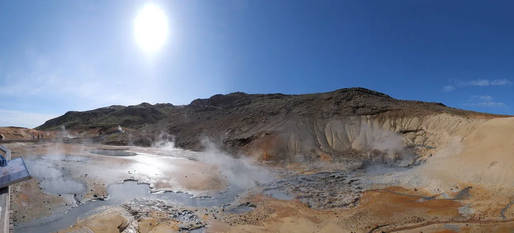
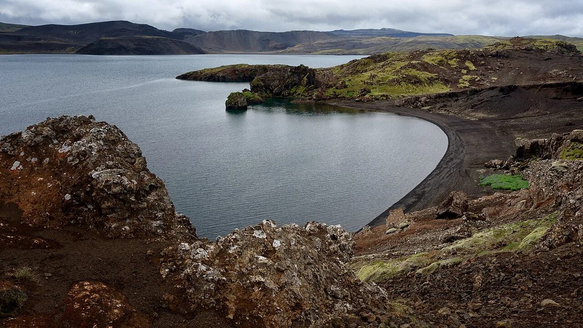
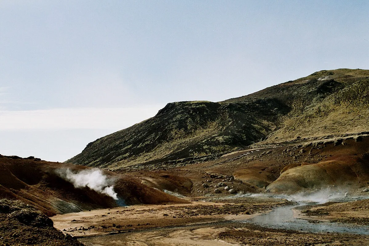
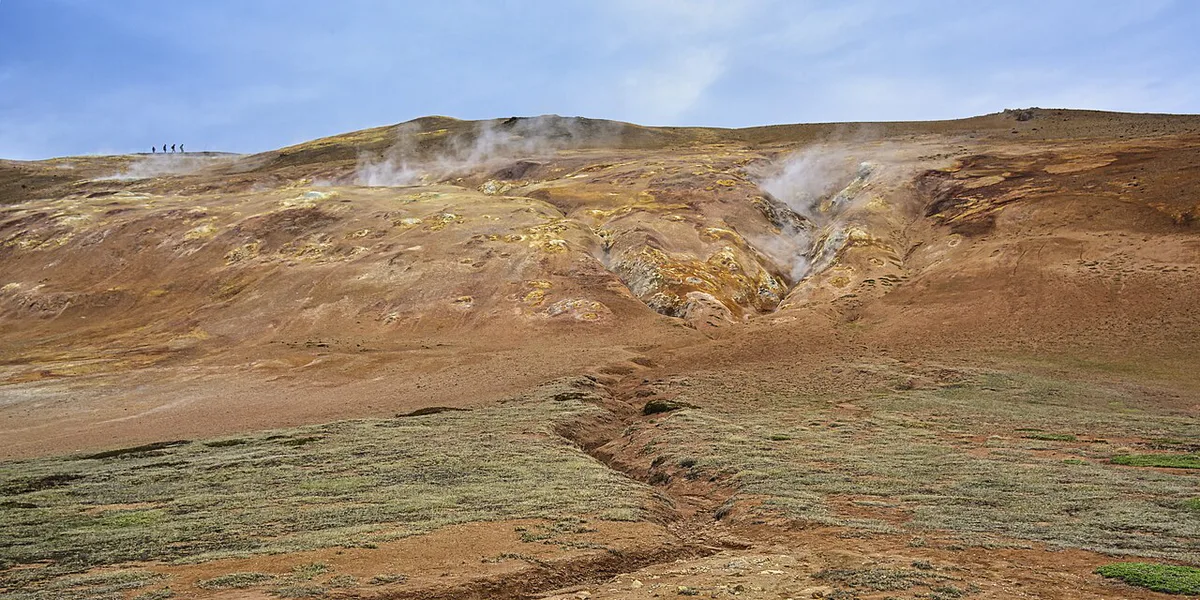
Seltún packs the classic geothermal features into a small area. Mud pots bubble and hiss beside the path. Steam vents push sulfurous clouds across the boardwalk, and the hillsides are stained yellow, orange and rust where sulfur reacts with iron in the soil. A boardwalk loop with information signs winds through the active ground. Nearby, the crater lake Grænavatn is known for its emerald green color, which comes from dissolved geothermal minerals. Seltún sits within a wider plate-boundary landscape, which our explainer on why Iceland has so many volcanoes unpacks in plain terms.
Krýsuvík geothermal field: geology and nearby stops
Seltún is only the most visited corner of a much larger system. Krýsuvík belongs to the Krýsuvík-Trölladyngja volcanic system, a belt of fissures, craters and lava flows that crosses the middle of the Reykjanes Peninsula. The heat under the ground here is what drives the mud pots and steam vents on the boardwalk, and it is also why the soil changes color so sharply over a few meters.
Route 42 passes several other places worth a short stop, so Seltún does not have to be the only one.
- Kleifarvatn: the largest lake on the peninsula, set among dark slopes beside the road. Local accounts say its water level dropped after earthquakes around the year 2000. It has no facilities, but the shoreline is a good place to stretch your legs.
- Grænavatn: the small emerald crater lake already mentioned near Seltún, a few minutes on foot or by car from the main parking area.
- Krýsuvíkurbjarg: sea cliffs on the south coast with seabird colonies in summer. Allow extra time and check the surface of the access road before you commit.
- Ögmundarhraun: a lava field on the coast side, formed in a medieval eruption and now covered in thick moss.
Seltún itself takes about 60 minutes, as the at-a-glance box says. Adding Kleifarvatn and Grænavatn stretches the stop to roughly two hours, and the cliffs and lava field need more than that. Because these spots sit on open ground with no shelter, the wind and road checks described under volcanic activity apply to all of them. Fuel up and use a toilet in Hafnarfjörður or Reykjavík beforehand.
Is Krýsuvík (Krysuvik) worth it? Who it suits and who can skip
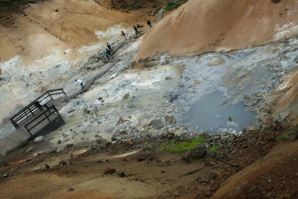
Krýsuvík earns its place if you want mud pots and steam vents without a long detour. It is a 60-minute stop, not a half-day outing. Photographers, families with children who can follow a boardwalk, and anyone driving the Reykjanes Peninsula will get good value. You can skip it if you only have a few hours in Iceland and already plan to see Gunnuhver or Geysir. Skip it too if you expect a hot spring to soak in. Seltún is for looking, not bathing, and the water and ground here are dangerously hot.
How to get there
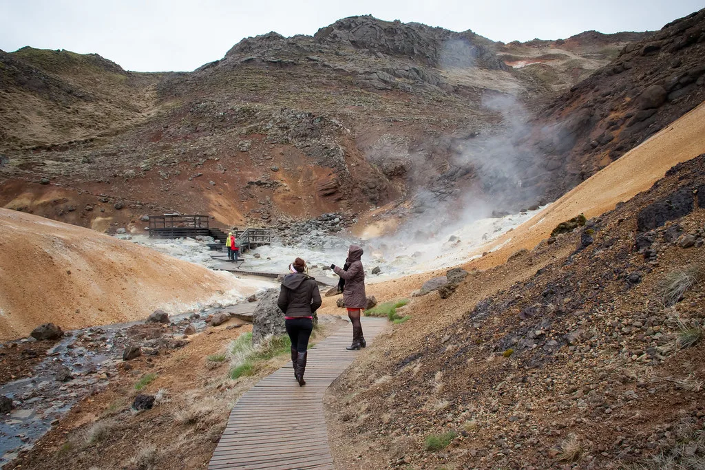
Self-driving gives you the most control. Take Route 41 toward the Reykjanes Peninsula, then follow Route 42 to the Seltún parking area. Guided Reykjanes tours often include geothermal stops, so check each itinerary for Krýsuvík by name. Our overview of Iceland Volcano Tour: Types, Timing and How to Choose shows what the guided options look like. Public transport to the site is limited. Check the current Strætó timetable and do not rely on any bus number you find on a listing site.
Route 43 leads to Grindavík, so keep it out of your navigation when you follow Route 41 and Route 42 to Seltún.
| Option | Control | Cost tier | Winter risk |
|---|---|---|---|
| Self-drive | Highest: stop when you like | Fuel plus car rental | You drive in wind and ice yourself |
| Guided tour | Fixed itinerary and timing | Paid, varies by operator | Operator decides on conditions |
| Public bus | Low and timetable-bound | Lowest, if service exists | Depends on service; limited |
| Taxi | High for a single trip | Highest per trip | Driver judges road conditions |
Boardwalk safety and what to bring
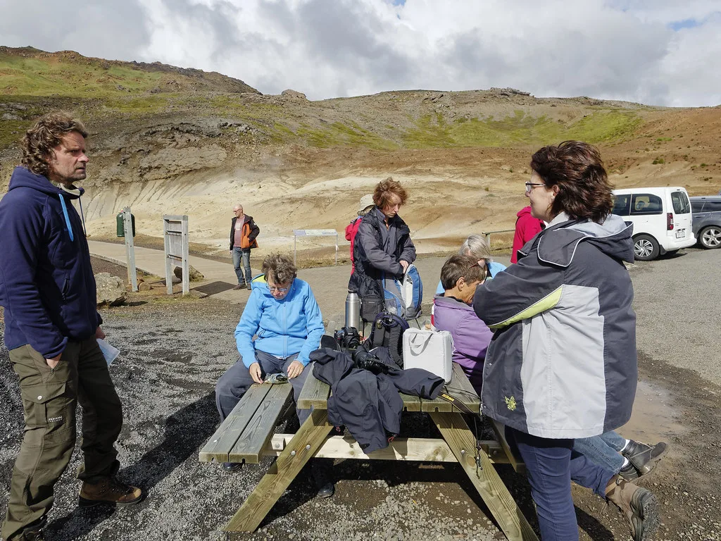
Stay on the boardwalk at all times. One local guide puts ground and water temperatures at 80 to 100°C (176 to 212°F), and the crust between vents can be thin. Leaving the path risks scalding burns. Wear shoes you can wash, because sulfur and mud stain fabric. Pack windproof layers, since the exposed landscape feels cold on blustery days. Bring your own water and snacks, because there are no facilities on site.
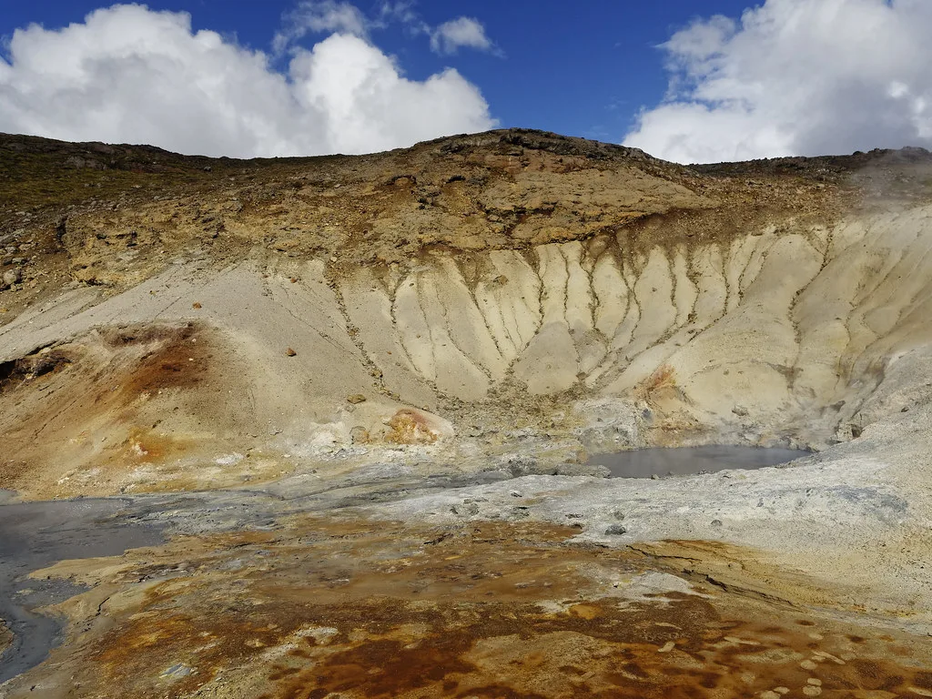
- Do not step off the boardwalk, even for a photo.
- Do not touch mud pots, pools or steam.
- Do not wear suede or light canvas shoes.
- Do not treat Krýsuvík as a standalone half-day trip.
Krýsuvík vs. Gunnuhver vs. Geysir
All three are geothermal stops, but they sit in different parts of the country. Gunnuhver is also on the Reykjanes Peninsula, so it pairs easily with Krýsuvík. Geysir lies on a different route, so it needs a longer drive from Reykjavík. If you have time for only one, pick by region rather than by feature. Check each site's current access details before you set off.
| Stop | Drive from Reykjavík | Visit length | Best for |
|---|---|---|---|
| Krýsuvík (Seltún) | Short | About 60 minutes | Mud pots on a Reykjanes day |
| Gunnuhver | Short to medium | Short stop | Combining with other Reykjanes sights |
| Geysir | Longer drive | Longer stop | A dedicated inland day |
Combining Krýsuvík with other Reykjanes stops
Treat Krýsuvík as one link in a peninsula loop. A full loop puts Seltún early, then moves on to Gunnuhver and the coast. The lava terrain along the way is covered in our guide to Iceland's lava fields. A Blue Lagoon day can include Krýsuvík on the way, which spreads the driving and gives you a dry-land stop before bathing. A Krýsuvík-only trip works as a quick outing from Reykjavík when time is tight. Start early in winter so the daylight lasts through your last stop.
Reykjavík to Krýsuvík is reported at 30 to 45 minutes, so the Blue Lagoon route can take it on the way.
Volcanic activity and checking conditions
Reykjanes is an active volcanic region, and eruptions in recent years have changed access in places. Do not assume any road or trail is open. The Icelandic Met Office publishes volcanic and geothermal updates. For road and safety alerts, use Safetravel Iceland before you leave. Our page on Iceland volcano eruptions explains how events unfold. For wider context, read whether it is safe to travel during an eruption. Another volcanic system worth knowing is Hengill.
Best time to visit Krýsuvík
Krýsuvík is accessible year-round, so no month rules it out. Winter brings short daylight, slippery boardwalk surfaces and strong wind across the open ground. Summer offers long light and easier driving. Steam shows best on cold, still days, and low sun gives the mineral colors more contrast. Rain makes the boardwalk slick and the mud heavier on your shoes. Check wind and road alerts on the morning you go, and pick a calmer day if you can.





