
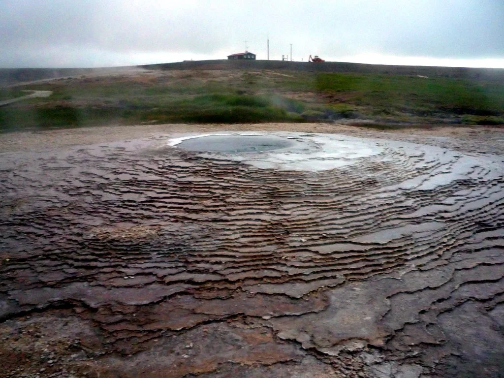
Hveravellir Guide: Hot Springs, F35 Access and Tips
Last updated November 2026: Hveravellir is a geothermal area on the F35 Kjölur route, between the Langjökull and Hofsjökull glaciers. Fumaroles, marked paths and one main bathing pool make it a practical Highlands stop. Access is 4x4 only and seasonal, so settle the road status before you plan the soak.
Featured image: rwhgould, CC BY-SA 2.0, via Flickr.
What You'll Find at Hveravellir
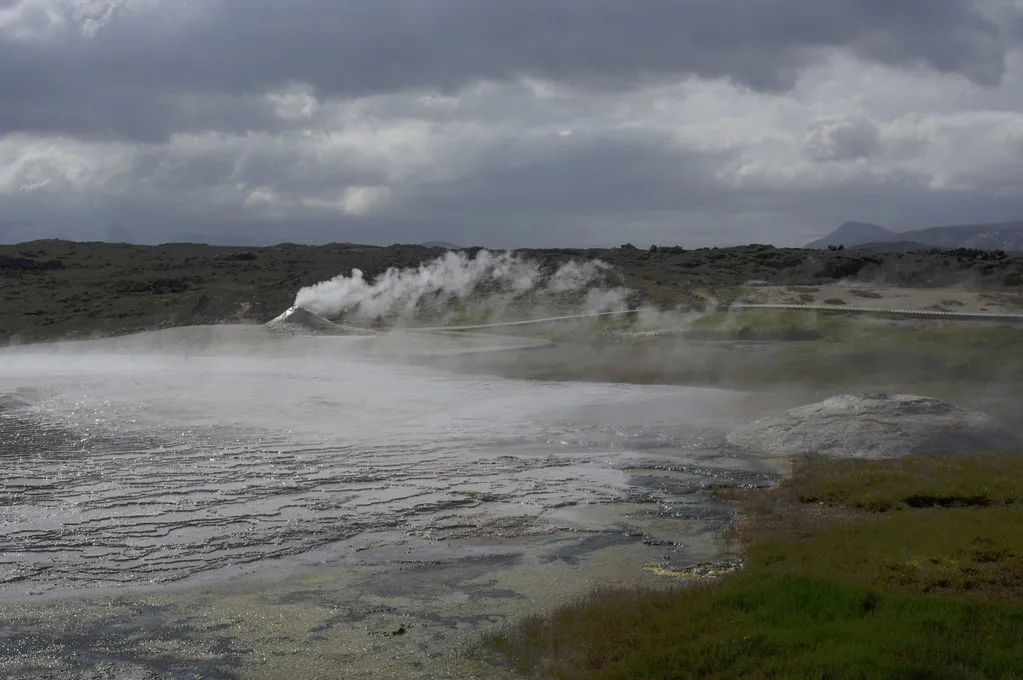
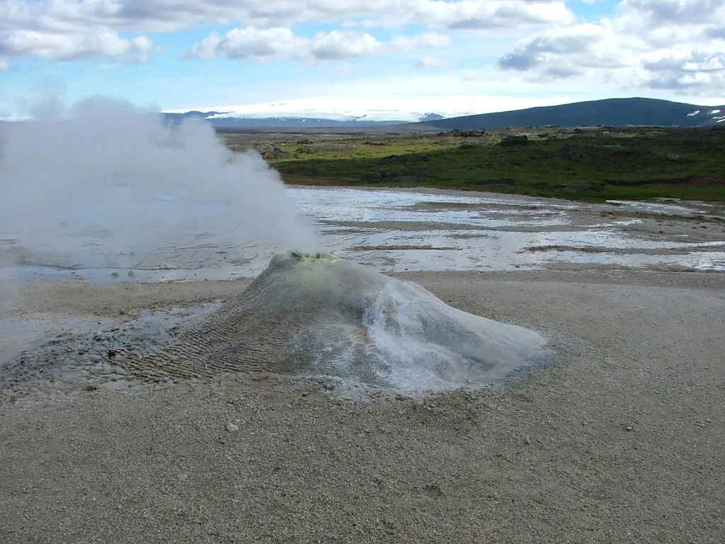
Hveravellir sits in the central Highlands, roughly midway along the Kjölur crossing. Steam rises from fumaroles, and marked paths loop past the hot ground. Mountain huts and basic facilities make it a working highland base rather than a spa. Set expectations accordingly: you get one proper bathing pool, not a string of soaking spots.
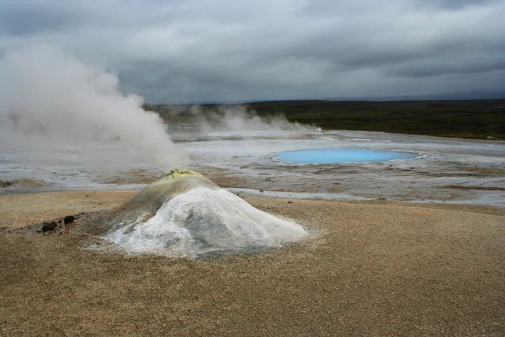
- Geothermal walk: marked paths pass fumaroles, the blue Bláhver pool and the Eyvindarhver spring. These are for looking at, not for bathing.
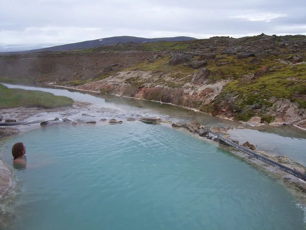
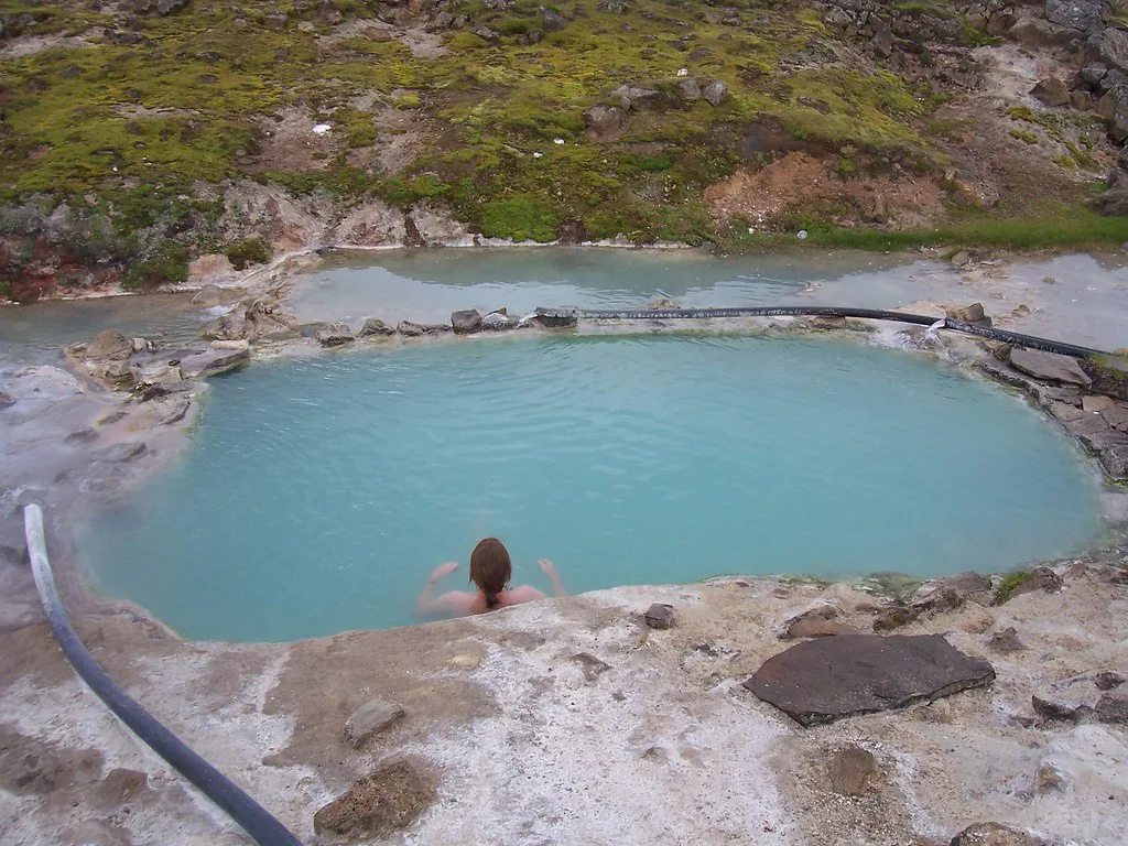
- Bathing pool: a natural hot pool about a 2-minute walk from the car park. It is the one main bathing spot, and the other hot features are not safe to enter.
- Huts and cafe: lodging, a small restaurant by the parking area and other facilities sit close to the pool.
How to Get to Hveravellir on the F35 Kjölur Route
Hveravellir lies on F35, the gravel Kjölur road that links South and North Iceland. You need a 4x4 vehicle, and a 2WD car is not suitable. From the south, drivers usually join F35 beyond Gullfoss. From the north, the approach starts on the Blönduós and Varmahlíð side. A short, easy spur leads off F35 to the car park by the restaurant. Drivers coming from the Golden Circle can pair the trip with the Geysir geothermal field. The turn-off for F347 toward Kerlingarfjöll sits on the same road, so the two stops combine easily. F-roads open only in summer, and the opening date changes each year. Check current F35 conditions before you leave. Then look at Safetravel weather and road alerts on the morning of the drive. Exact distances and drive times are on Road.is route data, so use those rather than a rough guess.
How Much Time to Plan
A quick stop for a soak and a coffee fits into about 1 hour. Walking the whole geothermal area on foot takes roughly 1 hour on its own. Plan 1 to 2 hours if you want both the paths and the pool without rushing. An overnight stay in the huts or at the campsite suits travelers who want long highland evenings. Stargazing and northern lights depend on the season and clear skies, so treat them as a bonus.
Costs, Booking and Facilities
Fees for parking, bathing, huts and camping are set locally and change by season. Check the site operator's page and Visit Iceland for current ISK rates.
Where to Stay and Eat
Hveravellir offers mountain huts and camping beside the geothermal area. A small restaurant stands next to the car park, so a hot drink or meal is possible without carrying everything. Pack a swimsuit, a towel, warm layers and some food for backup. Fuel and phone signal are limited in the Highlands, so fill the tank before you enter Kjölur. At each end of the route, towns and lodges offer more choice. Kerlingarfjöll also has its own highland lodging off F347.
Hveravellir vs. Kerlingarfjöll vs. Landmannalaugar
All three are Highlands geothermal stops, but they serve different trips. Hveravellir is the easiest to slot into a Kjölur drive. This table compares them in short form.
| Site | Access road | Bathing | Best fit |
|---|---|---|---|
| Hveravellir | F35 spur, 4x4 | One main pool near the car park | Kjölur crossing, short soak stop |
| Kerlingarfjöll | F35 then F347, 4x4 | Separate hot pot; Hveradalir mud pots are not for bathing | Hikers who want colorful geothermal slopes |
| Landmannalaugar | F208, 4x4; check locally which side | Warm stream mixing into a river | Multi-day hikers and campers |
Safety and Weather in the Highlands
Hveravellir steams because Iceland sits on an active rift, as the reasons behind Iceland's volcanism explain. Stay on marked paths, because the ground around fumaroles and springs can scald. Highland air stays cold even in mid-August, and rain and fog can arrive quickly on F35. Follow Icelandic Met Office forecasts before you commit to the crossing. For wider volcanic context, see Iceland's volcano overview.
- Do not step off the path onto geothermal ground.
- Do not assume a 2WD car will do.
- Do not arrive without a fuel plan.
- Do not expect several bathing springs.
- Do not ignore a weather or road alert.
Sample Itineraries and When to Skip It
As a lunch and soak stop, Hveravellir breaks up a full Kjölur crossing between the south and north ends. As an overnight, it works for travelers who want a quiet highland evening. Skip it if F35 is closed, if you have no 4x4, or if you want several soaking pools. Lower-altitude alternatives are easier. Try Gunnuhver's steam vents on the Reykjanes peninsula. Another option is Krýsuvík's geothermal field. Volcanic landscape fans can also browse Iceland's lava fields.
A closed F35 also cuts off the F347 turn toward Kerlingarfjöll, so a shut road ends both stops.
A Simple F35 Go-or-No-Go Check
Make the F35 crossing a same-day decision, not a fixed promise. Before leaving the Golden Circle or the north coast, check the Icelandic Road Administration updates on Road.is for F35. Then review Safetravel alerts and the Icelandic Met Office forecast. F-roads open only in summer, and conditions can change after rain, fog or strong wind.
Bring a suitable 4x4, a full fuel tank, food, warm layers, a swimsuit and a towel. Do not rely on services or phone signal once you are in the central Highlands. If F35 is closed, turn back rather than trying an alternative track. A closure can also affect plans to continue on F347 toward Kerlingarfjöll.
Leave enough daylight for the crossing and for the short spur into Hveravellir. If the road status is uncertain, choose a lower-altitude geothermal stop instead. Hveravellir is most rewarding when the route is safely open and you can enjoy the paths and pool without rushing.




