Isola Ferdinandea: The Sunken Volcano Island of Sicily
Last updated November 2026: Isola Ferdinandea, also called Graham Island, is a submerged volcano in the Strait of Sicily, and there is no island to land on today. Its summit lies roughly 6–9 m below the surface, depending on the survey, so only a boat or a dive gets you over it. Regional context starts with our guide to Sicily's volcanoes, and the sections below cover the 1831 story and your visiting options.
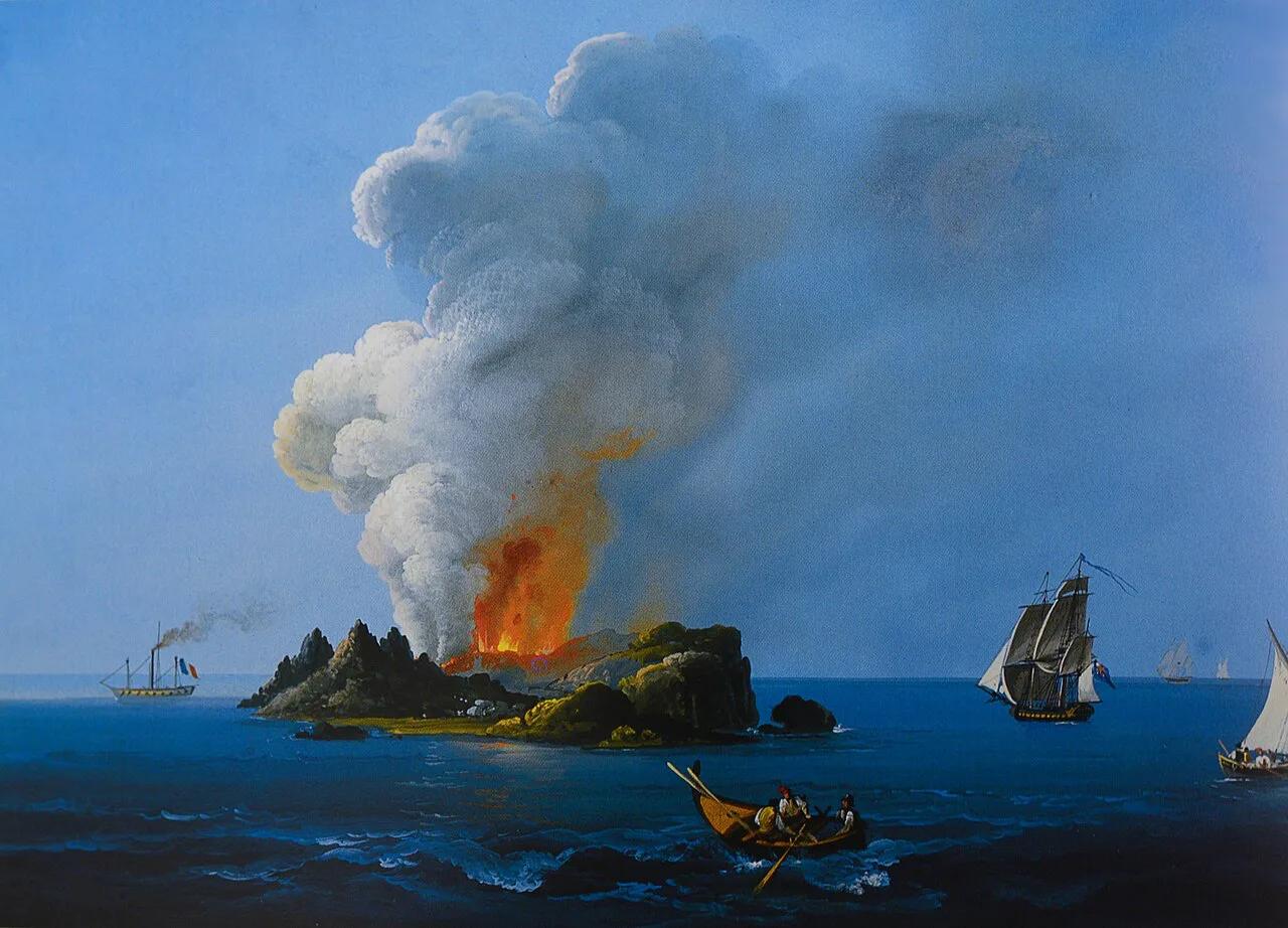
Featured image: Camillo De Vito, Public domain, via Wikimedia Commons.
What Isola Ferdinandea (Graham Island) is, and where it is today
Isola Ferdinandea is the drowned summit of a volcanic cone in the Strait of Sicily. In July 1831 it pushed above the waves as a temporary island. Waves erased that island within months. Today a shoal remains, with its top roughly 6–9 m under the surface depending on the survey. Nothing is visible from the Sicilian coast or from a boat deck. It sits between Sciacca and Pantelleria, and a map of Italy's volcanoes shows how far it lies from the land volcanoes. Sources disagree on several numbers, so the table gives ranges with attribution.
| Fact | Range or value | Who says what |
|---|---|---|
| Common names | Isola Ferdinandea, Graham Island, Île Julia | Italian, British and French names from 1831 |
| Position | About 37°10′N, 12°43′E | Published coordinates |
| Distance from Sciacca | About 30 km to 50 km | Italian-language references give 16 nautical miles (about 30 km); INGV gives 40–50 km offshore |
| Distance from Pantelleria | About 55 km | Italian-language references give 29 nautical miles |
| Summit depth today | 6–9 m below the surface | Surveys quote 6.9 m, about 8 m and 9 m |
| 1831 cone height | About 60–65 m above sea level | INGV says about 65 m; other accounts say 63 m |
| 1831 cone size | Under 300 m wide, nearly 1 km perimeter | INGV; other accounts give a 4,800 m circumference |
| Volcanic field | About 10 cones along a 12 km north–south line | INGV, Graham Volcanic Field |
| Activity state | Quiescent, with gas emissions | INGV |
- Isola Ferdinandea: the Italian name, given in honour of King Ferdinand II of the Two Sicilies.
- Graham Island: the British name, after Sir James Graham, First Lord of the Admiralty. Graham Bank is still the chart name for the shoal.
- Île Julia or Isola Giulia: the French name, chosen because the island was born in July.
- Nerita and Terribile: neighbouring banks, not other names for the same summit.
- Corrao, Hotham and Sciacca: older names recorded after the 1831 dispute.
Can you visit Isola Ferdinandea?
No rock breaks the surface, so you cannot land on Isola Ferdinandea. Visiting means a boat ride over the bank or a dive onto the summit. INGV's description of the shoal calls it the relic of the island and says it can be explored easily. That page puts the summit at 9 m below sea level. Other surveys give 6.9 m. Use the options below as decision criteria.
- Boat only: you cross open sea to the bank's position and see water. This suits history readers who accept a view with nothing to photograph.
- Snorkelling: the summit lies 6–9 m down, so water clarity and sea state decide whether you see it at all. Ask a licensed operator whether they run snorkel stops.
- Diving: the summit depth is modest. Italian-language references describe slopes dropping to 60–100 m beyond roughly 200 m of the top. Your certification level and the boat's briefing matter more than the summit depth.
- Rules: sea access and any restrictions sit with the Guardia Costiera and the local port authority. Ask them or your operator what applies to your dates.
How to plan a trip toward the Ferdinandea bank
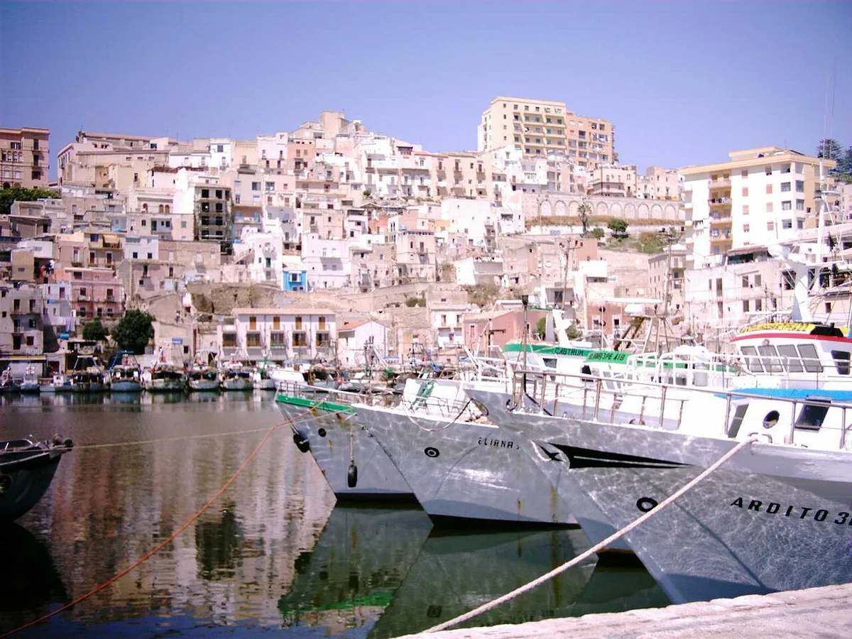
Sciacca, in Agrigento province, is the mainland town INGV uses as its reference point, placing the cones 40–50 km offshore. Italian-language references give a shorter 16 nautical miles, about 30 km. Either way, expect an open-sea crossing rather than a short harbour hop. Agrigento and Palermo are the larger cities you would transfer from. Local operators can tell you road and bus times to the departure port.
- Sea state: open-water trips depend on swell and wind, so keep your dates flexible by a day or two.
- Season: calmer water makes boat and dive trips more likely to run. Ask operators which months they sail.
- Certification: ask what level they require for a 6–9 m summit and for the deeper slopes.
- Crossing time: ask for the one-way time and the departure port.
- Safety: ask about oxygen, surface support and insurance for open-sea diving.
- Booking: choose a licensed centre in Sciacca or on the nearby coast, and request a written quote in euros.
Time, cost and effort: which option fits you
Operator rates are set by individual dive centres, and official volcano sources publish none. Ask for a written quote in euros before you commit. The table ranks each route by effort, not by price.
Plan around a 40–50 km open-sea crossing from Sciacca, since that distance, not the 6–9 m summit depth, shapes the effort.
| Option | Effort and time | Access | Best for |
|---|---|---|---|
| Read about it from the mainland | Low effort, low time | Anywhere; Sciacca's waterfront for local context | History readers |
| Boat trip over the bank | Medium effort; open-sea crossing, weather permitting | Licensed operators near Sciacca | Curious travellers who accept seeing only water |
| Dive trip | High effort; training, gear and a long day | Certified divers through a licensed centre | Experienced open-water divers |
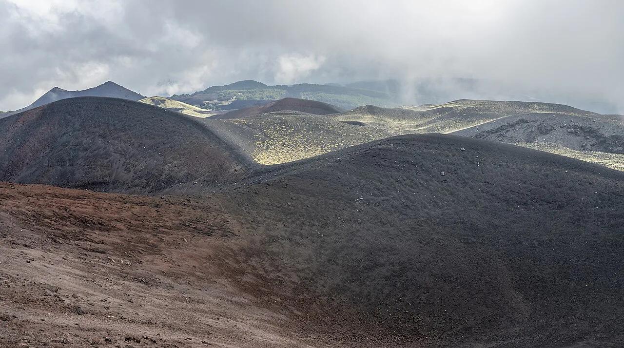
| Visit a land volcano instead | Low to medium effort | Marked trails, guided tours and park offices | Most visitors |
The 1831 story of Graham Island in short
Graham Island's rise began with tremors in late June 1831. Reports from Sciacca describe earthquakes, a sulfur smell and smoke over the sea by early to mid-July. INGV dates the start of the eruption to 7 July 1831. A cone grew to about 65 m above sea level, according to INGV, which says it was under 300 m wide. Other accounts give 63 m high and a 4,800 m circumference. Britain, the Two Sicilies and France each named the islet, and Spain voiced ambitions. Activity stopped in mid-August, and waves began stripping the loose ash and cinders.
- 17 July 1831: Sicilian customs official Michele Fiorini is reported to have landed and claimed the islet for the Two Sicilies.
- August 1831: British captain Humphrey Fleming Senhouse plants the Union Jack and names it Graham. Accounts give 2 August and 24 August.
- 17 August 1831: Ferdinand II of the Two Sicilies issues a decree naming it Ferdinandea.
- 27–29 September 1831: French geologist Constant Prévost and painter Edmond Joinville survey the islet and call it Julia.
- December 1831 to January 1832: observers report no trace of it, and accounts differ on the exact date.
The science: Empedocles, the Graham Volcanic Field and why the island vanished
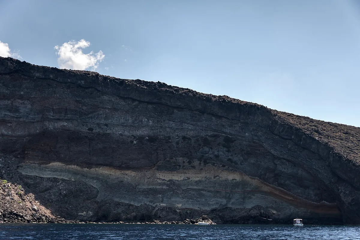
INGV places Ferdinandea in the Graham Volcanic Field, a monogenic field of about ten cones. Each cone rises roughly 100 m on average from the seabed. They line up along about 12 km in a north–south direction. Together with Pantelleria and Linosa, the field belongs to a larger, little-explored volcanic province shaped by stretching of the crust in the Strait of Sicily. Italian-language references describe the bank and the neighbouring Terribile and Nerita banks as accessory cones of the Empedocle volcano, which rises about 500 m from the seabed. Global catalogues group the area as the Campi Flegrei del Mar di Sicilia. INGV calls the 1831 activity Surtseyan, meaning explosive interaction of magma with shallow seawater. Its tephra was highly crystalline basalt enriched in sodium. Loose ash, lapilli and scoria hold together poorly, so waves stripped the islet in about two months. A 2012 survey on 17–21 July mapped 9 monogenic craters in the area. Another large submarine volcano in our coverage is the Marsili submarine volcano.
Will Isola Ferdinandea rise again?
INGV lists the volcano as quiescent, with gas emissions as its main current phenomenon. Its last eruption is recorded as 1831, with 1863 marked as uncertain. Seismic unrest in 2000 and 2002 led some volcanologists to expect a new island, yet no eruption followed. A pressure sensor was placed on the summit in September 2006 and recovered on 22 September 2007. Divers have also left a plaque and a flag on the summit, and accounts differ on dates. Nobody has forecast an eruption, so treat any re-emergence talk as speculation. For current status, read INGV's monitoring pages. Volcanoes that erupt regularly are a different matter, and Italy's active volcanoes compares them.
- Myth: you can see Ferdinandea from the surface. Fact: the top lies roughly 6–9 m down, so nothing shows.
- Myth: the 1831 dispute made it British, French or Sicilian. Fact: the four-way claim was never settled, and the island sank first.
- Myth: it is about to rise again. Fact: INGV lists it as quiescent, and the 2000 and 2002 unrest produced no eruption.
Isola Ferdinandea in culture and literature
The short-lived island left a mark on writers. The works below name it or took inspiration from it.
- James Fenimore Cooper: The Crater, or Vulcan's Peak.
- Alexandre Dumas: The Speronara.
- Jules Verne: Captain Antifer.
- Terry Pratchett: Jingo.
Volcanoes you can actually visit
If a sunken shoal is not what you want, pick a volcano with a trail or a crater rim. A comparison of Stromboli and Etna helps you choose between two active cones. Etna's visitor information comes from Etna's park authority. Guided options are listed under guided volcano tours in Italy. From Naples, start with Volcanoes Near Naples: Vesuvius, Campi Flegrei & Ischia. From Rome, Volcanoes Near Rome: What You Can Actually Visit cover the closer choices. Quiet land volcanoes such as Monte Amiata: Tuscany's Dormant Volcano Visitor Guide suit slower trips. Our guide to volcanoes across Italy collects every option in one place.