Vogelsberg Guide: Germany's Largest Volcanic Area
Last updated November 2026: the Vogelsberg is an extinct volcanic massif in Hesse, central Germany, covering about 2,500 km² (970 sq mi). Described as Central Europe's largest connected basalt area, it lies roughly 60 km (37 mi) northeast of Frankfurt. Come for forest walks, cycleways and old towns, and read our guide to volcanoes in Germany if you want craters.
Featured image: UuMUfQ, CC BY-SA 3.0, via Wikimedia Commons.
What the Vogelsberg is, and who should visit
Vogelsberg is a broad, forested upland, not a cone you can point at. Taufstein, at 773 m (2,536 ft), is the highest point. Hoherodskopf, at 763 m (2,503 ft), is the main visitor hub. Volcanic activity ended roughly 7 million years ago, so no eruption hazard exists today. Walkers, cyclists and winter-sports fans get the most from the area. Volcano enthusiasts on a short Germany trip should set expectations accordingly. Gentle slopes, beech forest and basalt outcrops replace crater rims and lava fields.
- Location: Hesse, mainly in the Vogelsbergkreis, in the zone between Alsfeld, Fulda, Büdingen and Nidda.
- Size: about 2,500 km² (970 sq mi), built from many small volcanoes rather than one mountain.
- High points: Taufstein at 773 m (2,536 ft) and Hoherodskopf at 763 m (2,503 ft).
- Status: extinct, with volcanic activity finished about 7 million years ago.
- Gateway: Frankfurt, roughly 60 km (37 mi) southwest of the massif.
Where the Vogelsberg is and how its regions differ
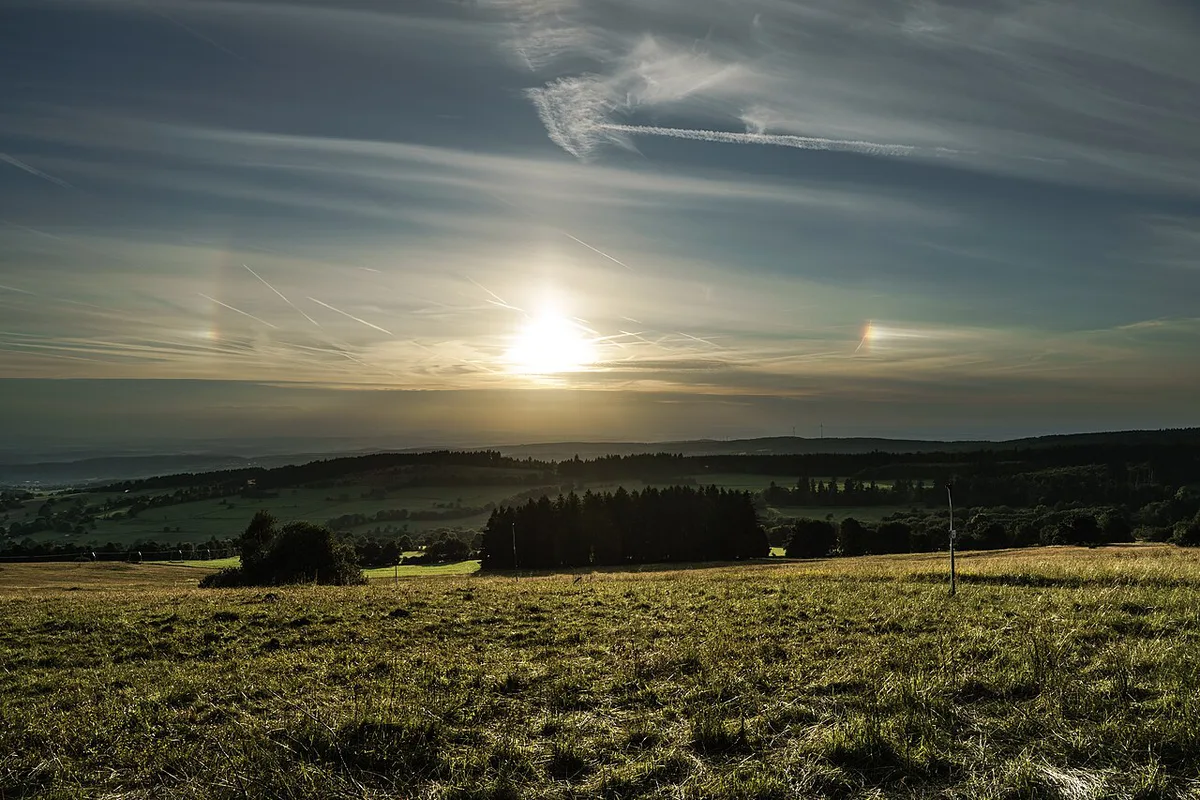
Four zones shape any itinerary. Oberwald is the forested core, with its edge near the 600 m (1,968 ft) contour. High Vogelsberg surrounds it and holds the sources of rivers in both the Rhine and Weser systems. Lower Vogelsberg mostly sits between 300 and 500 m (984 and 1,640 ft), with pasture, farms and small towns. Giesel Forest covers about 130 km² (50 sq mi) and rests on sandstone, not basalt. Alsfeld, Fulda, Büdingen and Nidda are the towns that frame the massif. Within that frame, Hoherodskopf near Schotten is the easiest place to start.
| Region | Landscape | Best for | Access | Season |
|---|---|---|---|---|
| Oberwald | Almost fully forested plateau, 600 to 773 m, with stone runs and the Taufstein reserve | Forest walks, geology, summit views | Trailhead parking; check bus timetables | Spring to autumn on foot; winter if snow allows |
| High Vogelsberg | Springs, wetlands and stream valleys, with river sources | Nature trails, cross-country skiing, Hoherodskopf | Most bus routes aim for Hoherodskopf | Year-round, with snow varying by winter |
| Lower Vogelsberg | Pasture, farms and forest between 300 and 500 m | Old-town loops in Alsfeld, Lauterbach and Nidda | Easiest by car; towns have local services | Spring to autumn |
| Giesel Forest | About 130 km² of woods on sandstone, including pine | Quiet forest walking away from basalt | Car is the practical choice | Spring to autumn |
How the Vogelsberg volcano formed and what you can see
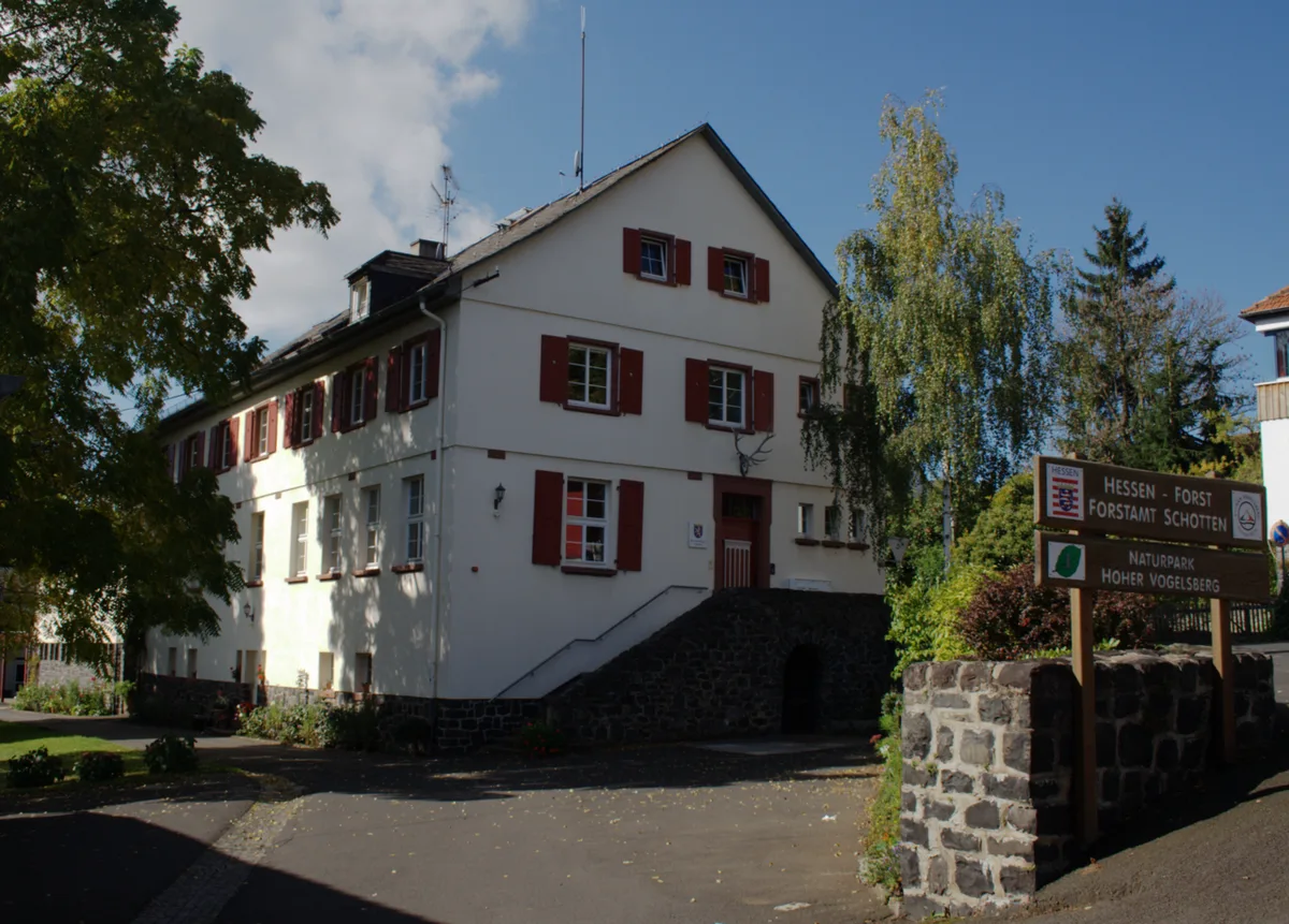
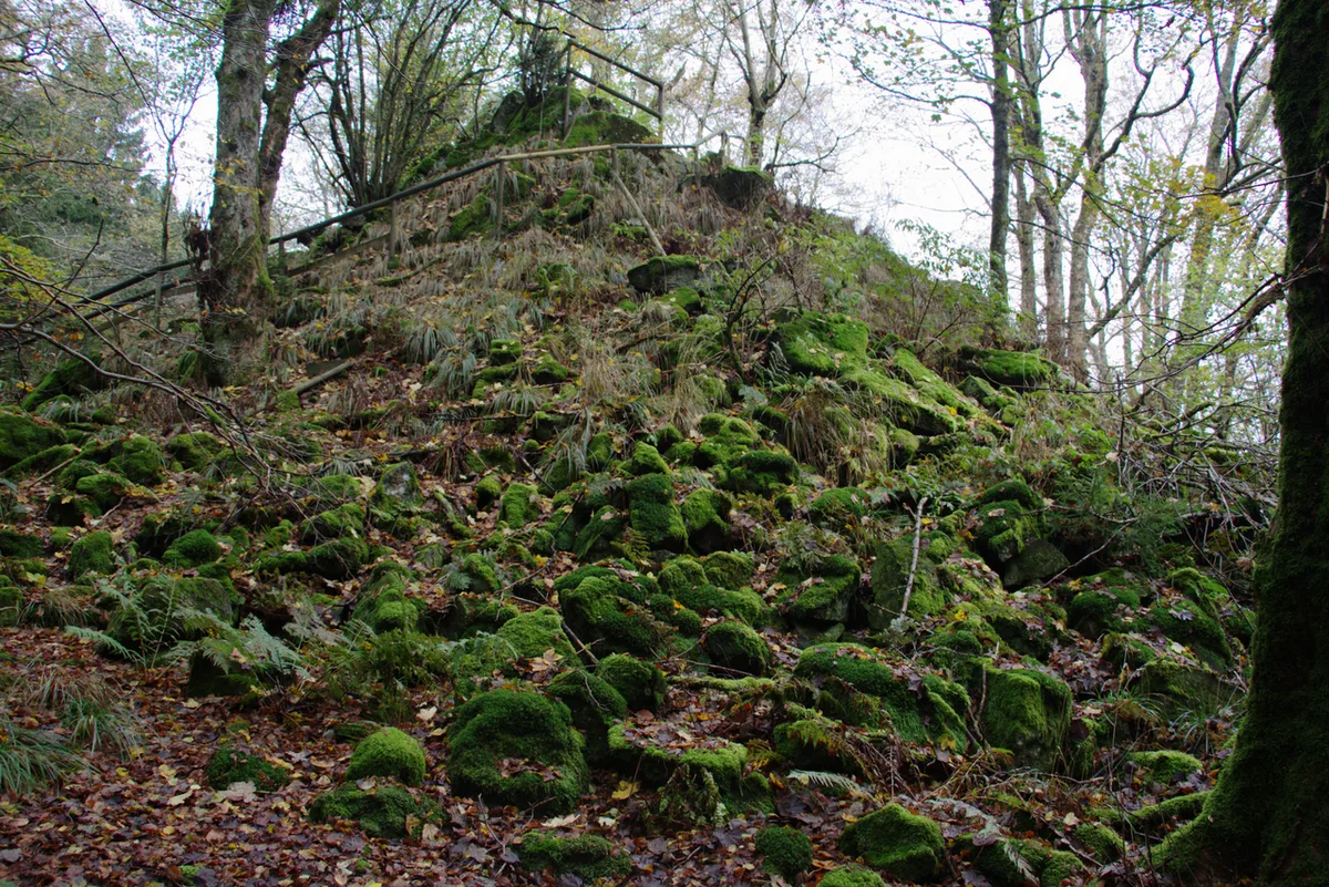
Eruptions began around 20 million years ago, peaked between 17 and 15 million years ago and stopped about 7 million years ago. Treat those dates as approximate. Many small volcanoes built the massif, not one mountain. Stacked basalt layers now read as terraces stepping down from the Oberwald plateau. Uplift and erosion later flattened everything into today's shield shape. No part of the area counts as an eruption hazard. Visible evidence is modest but real. Uhuklippen rocks are a natural monument, and stone runs of loose basalt blocks cover the northern Taufstein slopes. Beech forest in the Taufstein reserve has been left to grow naturally since 1906. Bismarck tower on the Taufstein gives a lookout over the surrounding forest. Geotour routes from Vulkanregion Vogelsberg explain the rocks along the way.
Best things to do in the Vogelsberg by traveler type
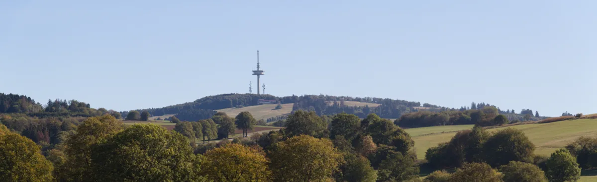
Group plans by traveler type, because the Vogelsberg rewards focus over sampling. Hoherodskopf anchors most visits. A nature-conservation information centre and a Schotten tourist office stand there and are reported open daily, so check current hours. Three nature trails cover geology, nature and the senses. Cyclists get about 70 km (43 mi) of marked mountain-bike routes plus two paved cycleways. Cross-country skiers can use about 55 km (34 mi) of trails when snow lies.
- Families: the summer toboggan run, the tree ropes course, the three nature trails and the restaurants at Hoherodskopf.
- Hikers: forest paths through the Oberwald toward Taufstein, the Uhuklippen rocks and the stone runs on the northern slopes.
- Cyclists: the Vulkanradweg and the Vogelsberger Südbahnradweg, both paved, plus the marked mountain-bike network.
- Winter visitors: alpine and cross-country skiing at Hoherodskopf and Herchenhainer Höhe, depending on snow.
- Culture seekers: old-town walks in Alsfeld, Lauterbach, Nidda and Grünberg.
- Lake visitors: Nidda Reservoir, Antrift and Gederner See for shoreline walks.
Hiking and cycling in the Vogelsberg: routes by effort
Define effort by time and climb, not by distance alone. Komoot rates a route easy when it takes up to 2 hours with up to 1,000 ft of climb on well-walkable paths. Moderate means up to 5 hours and 3,000 ft of climb. Old-town loops in Alsfeld, Lauterbach, Nidda and Grünberg all fall in the easy band. Listed lengths run from about 2.4 km (1.5 mi) in Grünberg to about 4.6 km (2.9 mi) in Lauterbach. Official route maps from the Vulkanregion and the Naturpark Hoher Vogelsberg are the better planning base, and komoot works as a planning tool.
| Effort | Typical outing | Length and time | Notes |
|---|---|---|---|
| Easy town loop | Alsfeld old town | About 2.2 to 2.6 km (1.4 to 1.6 mi), 35 to 42 min | Roughly 20 to 40 m of climb in route listings |
| Easy town loop | Lauterbach old town | About 4.6 km (2.9 mi) | Listed as easy, around 30 m of climb |
| Easy town loop | Nidda and Grünberg | About 4.4 km (2.7 mi) and 2.4 km (1.5 mi) | Short, flat loops; Grünberg's route follows war-damage sights |
| Forest and summit walk | Taufstein, Uhuklippen, Hoherodskopf trails | Plan a half day; effort moderate | Follow local signage in protected areas |
| Cycleway day | Vulkanradweg or Südbahnradweg | Long, paved, mostly car-free riding | Check bike carriage on buses first |
| Winter day | Hoherodskopf or Herchenhainer Höhe | Depends on snow | Check live snow status before travel |
How much time to plan for the Vogelsberg
Half a day suits one old town or one summit area. One day fits Hoherodskopf plus a forest walk toward Taufstein. A weekend lets you add a cycleway stretch and a second base town. Allow 35 to 42 minutes for the Alsfeld old-town loop, and add time for a meal. Two nights is the sensible limit for a first visit, since the region is quiet and spread out.
- Half day: Alsfeld old-town loop of about 2.2 to 2.6 km (1.4 to 1.6 mi), then lunch in town.
- One day: drive or bus to Hoherodskopf, walk one of the three nature trails, then head to the Taufstein lookout.
- Weekend: day one at Hoherodskopf and Taufstein, day two on a cycleway or in Lauterbach and Nidda.
Getting to the Vogelsberg and getting around
Frankfurt is the realistic gateway, roughly 60 km (37 mi) southwest of the massif. Fulda and Giessen also work as arrival cities. Regional rail and bus operators, including RMV, publish timetables for the area, and services are sparse outside peak times. Car travel gives the most freedom for forest trailheads, which typically offer a Wanderparkplatz. Car-free trips work best around towns and Hoherodskopf, where bus routes are reported to run. A weekend Vulkan Express bus with bicycle trailers is reported, so check the current timetable and season before building a plan around it. Many bus routes go to Hoherodskopf. German terms help: Naturpark means nature park, Vulkanradweg means volcano cycleway, and Wanderparkplatz means hikers' parking lot. Signage and most websites are in German. Follow local signs in protected areas such as the Taufstein reserve.
With about 70 km (43 mi) of marked mountain-bike routes, a car-free trip works around Hoherodskopf, but confirm bike carriage on buses first.
Costs, tickets and opening hours
Prices and hours checked November 2026. Walking, trails and cycleways cost nothing beyond travel. Two paved cycleways, the Vulkanradweg and the Vogelsberger Südbahnradweg, are open for riding and inline skating. Operators set their own prices for the summer toboggan run, the tree ropes course and the ski lifts, so check each operator's current price. Budget for them separately from free walking. The information centre and tourist office at Hoherodskopf are reported open daily, though winter and shoulder-season hours can differ.
Where to stay near the Vogelsberg
Choose between an old-town base and a mountain base. Alsfeld and Lauterbach give you old-town streets, with loops of about 2.2 to 2.6 km (1.4 to 1.6 mi) and 4.6 km (2.9 mi). Schotten has its tourist office on Hoherodskopf, at 763 m (2,503 ft), which makes it a natural base for summit and winter days. Rural lodging often depends on a car, so check public transport before booking.

| Base | Type | Best for | Car needed? |
|---|---|---|---|
| Alsfeld | Old-town base | Short walks, restaurants, first-timers | Helpful for trailheads |
| Lauterbach | Old-town base | Quiet stays and a longer town loop | Helpful |
| Schotten | Small town near the high ground | Hoherodskopf, Taufstein and winter days | Usually yes |
| Hoherodskopf area | Mountain base | Early starts on trails and snow | Check bus options |
Best season for the Vogelsberg
Skiing at Hoherodskopf and Herchenhainer Höhe depends on snow. Snow cover varies by year, so check live status before you travel. Precipitation climbs toward the Oberwald, reaching about 1,200 mm (47 in) a year. Temperatures drop toward the center of the massif. Spring and autumn suit forest walks among the beech stands of the Taufstein reserve. Summer suits cycling on the Vulkanradweg and the Südbahnradweg, plus the toboggan run and ropes course. Shoulder months can mean limited facilities, so check opening times for cafés and centres.
Forest walks toward Taufstein sit near the Oberwald, where rain climbs to about 1,200 mm (47 in) a year, so pack waterproofs.
Vogelsberg vs. Eifel, Kaiserstuhl and Siebengebirge
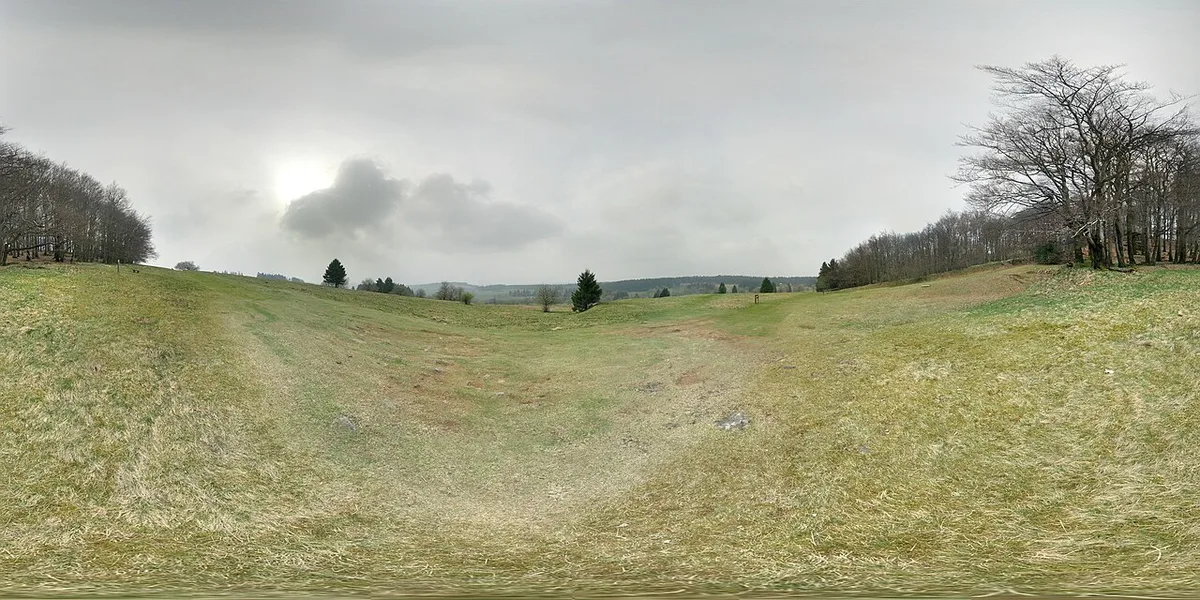
Vogelsberg is the gentle option among German volcanic areas, covering about 2,500 km² of worn-down basalt. Read our overview of German volcanic areas to see how each fits. Eifel is the stronger contrast, with a more dramatic landscape. Our Eifel volcanoes guide covers that side in full. Readers who want the live-volcano question answered can open our Eifel activity explainer. Details on Kaiserstuhl's volcanic hills sit in a separate guide. For the Siebengebirge, see its volcanic hills guide. Current Eifel visitor information is listed by Geopark Vulkaneifel. For more volcanic sights, visit the maar lakes of the Eifel. Another stop is the underground lava cellars at Mendig. A third is the geyser at Andernach.
| Area | Volcanic character | Visible evidence | Activity | Best for | Time to allow |
|---|---|---|---|---|---|
| Vogelsberg | Worn-down basalt shield from many small volcanoes | Terraces, stone runs, Uhuklippen | Extinct; ended about 7 million years ago | Walking, cycling, winter sports | Half day to a weekend |
| Eifel | More dramatic volcanic landscape | Maars, lava cellars, Andernach geyser | See our Eifel activity answer | Visible volcanism | Two days or more |
| Kaiserstuhl | Volcanic hills | See the Kaiserstuhl guide | See the Kaiserstuhl guide | Short volcanic stop | Half day to a day |
| Siebengebirge | Wooded volcanic hills | See the Siebengebirge guide | See the Siebengebirge guide | Short volcanic stop | Half day to a day |
Vogelsberg mistakes to avoid and who should go
Four errors cost visitors the most time. Go if you want quiet forest, cycleways and old towns within about 60 km (37 mi) of Frankfurt. Skip it if a visible crater is the goal.
- Expecting craters or lava scenery: the massif is a worn-down shield with terraces and stone runs.
- Relying on a weekend bus without checking: the Vulkan Express may have changed, so confirm season and timetable.
- Visiting in the shoulder season: some facilities at Hoherodskopf may be limited.
- Assuming winter snow: lifts and cross-country trails run only when snow allows.
- First-timers: go for one day at Hoherodskopf and Taufstein, then add Alsfeld.
- Families: go for the toboggan run, ropes course and nature trails.
- Hikers and cyclists: go for forest paths and the two paved cycleways.
- Volcano enthusiasts on a short trip: skip it and choose the Eifel.