Roque de Agando, La Gomera: Viewpoints, Access & Tips
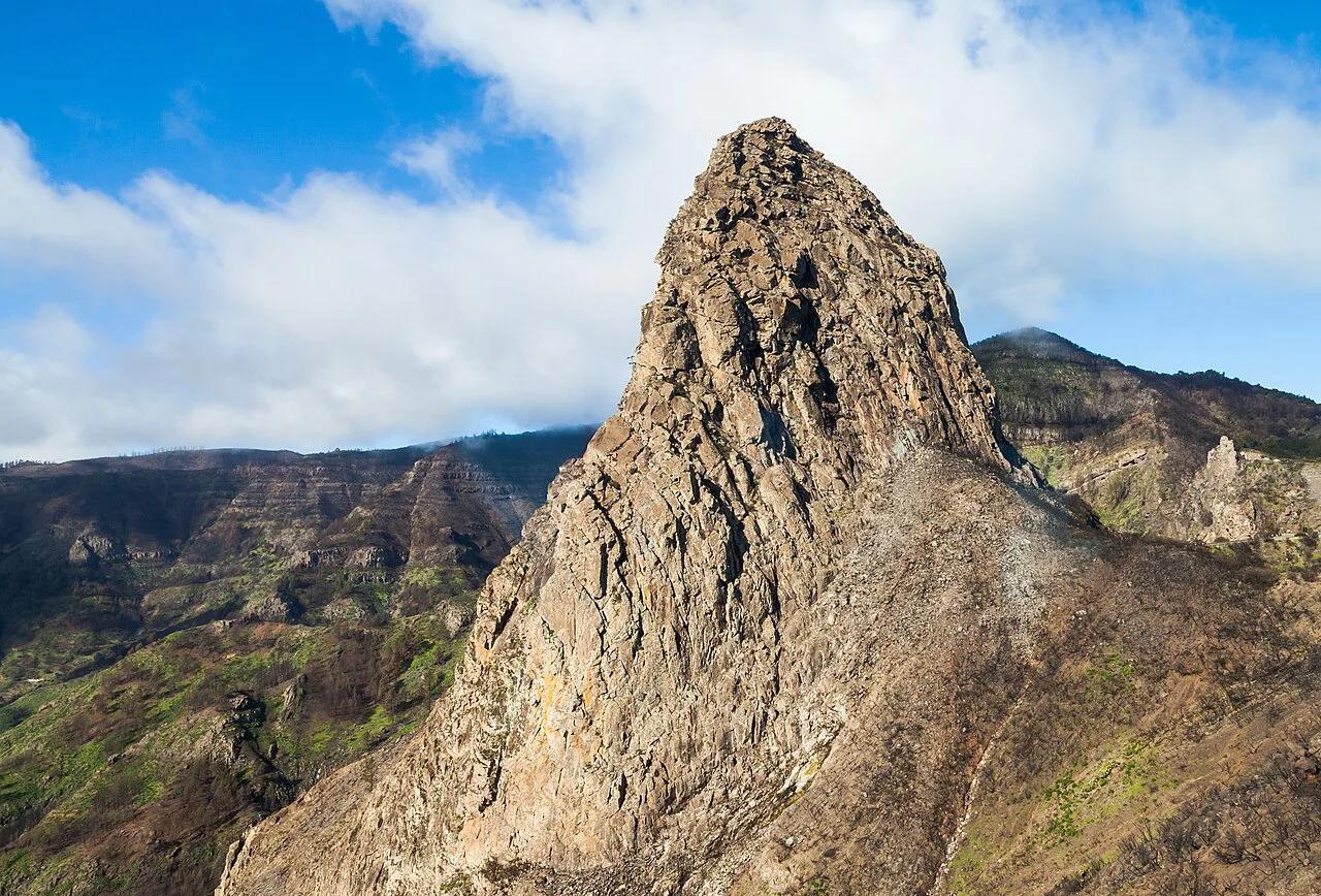
Last updated November 2026. Roque de Agando is a volcanic plug on La Gomera, seen from roadside viewpoints beside Garajonay National Park. It is a 15–30 minute photo stop rather than a hike, and cloud often hides it. Treat it as an add-on to a drive through the island's centre, and read on for viewpoints, access and a plan for foggy days.
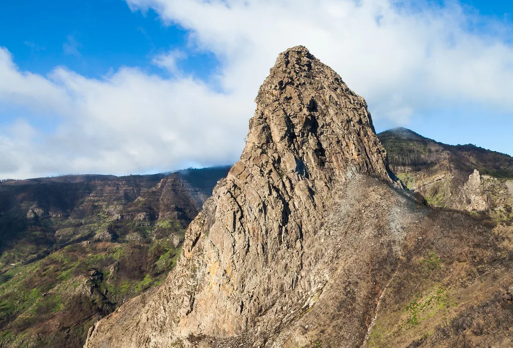
Featured image: Diego Delso, CC BY-SA 3.0, via Wikimedia Commons.
Quick answer: is Roque de Agando worth a stop?
Yes, if you are already driving through central La Gomera. It is a poor reason for a long detour on its own. The rock rises to about 1,246 m (roughly 4,090 ft), and some sources round that to 1,250 m. Plan on 15–30 minutes at the viewpoints, and expect clear skies to matter more than anything else. This is the island's best-known volcanic landmark, and it belongs to the wider story told in our Canary Islands volcanoes guide.
- What it is: a volcanic plug, the hard core of an old volcanic conduit
- Height: about 1,246 m (about 4,090 ft)
- Cost: no ticket; the viewpoints are open-air with no listed hours
- Time: 15–30 minutes at the viewpoints
- Best for: photographers, day-trippers from Tenerife and anyone combining Garajonay stops
- Poor fit: summit-seekers, and visitors with only one clouded day
Where to see Roque de Agando
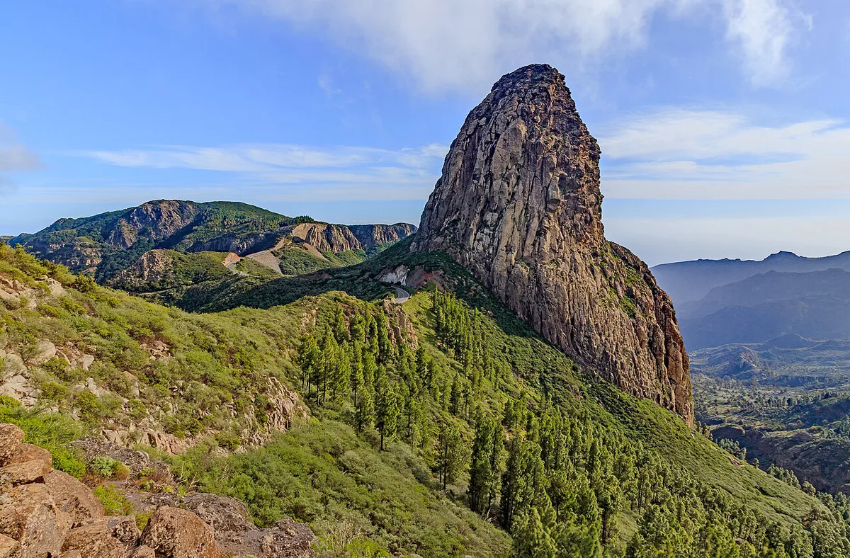
Two roadside viewpoints give you the classic views. Mirador de Los Roques ("viewpoint of the rocks") sits on the GM-2. Mirador del Morro de Agando is in the centre of the island beside the main road that crosses Garajonay. It has parking and looks toward the park, Los Roques and the Benchijigua reserve. Pick the Morro de Agando stop if you want a safe place to leave the car.
| Mirador de Los Roques | GM-2 | Not confirmed; check on arrival | The roque from the road | A quick photo while driving through |
| Mirador del Morro de Agando | Main road across Garajonay, in San Sebastián de La Gomera municipality | Yes | Garajonay, Los Roques and the Benchijigua reserve | A longer pause with the car parked |
How to get there
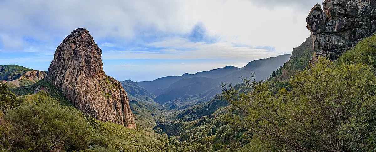
Drive. The GM-2 is the road that crosses the centre of La Gomera, and both viewpoints sit on or beside it. A car also lets you wait for a clear window, which a fixed tour or timetable cannot. Bus service to the viewpoints is not confirmed here, so check the island's Guaguas operator through La Gomera's official tourism site before relying on it. Guided tours trade flexibility for someone else handling the driving. Pair the roque with a Garajonay stop so a cloudy view does not waste the trip.
Drive the GM-2 to reach the viewpoints, then return later if cloud sits on the ridge and hides the rock.
Can you climb Roque de Agando?
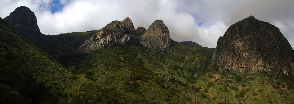
No. The summit is not accessible, and climbing is not permitted because the rock lies in a protected area. It forms part of the Monumento Natural de Los Roques, next to Garajonay National Park and the Benchijigua reserve. If you want to walk, head for the signed routes inside the park. Rules and trail information are on the Garajonay National Park page. Stay on marked paths and take your litter home.
Best time to go and what to do if it's clouded in
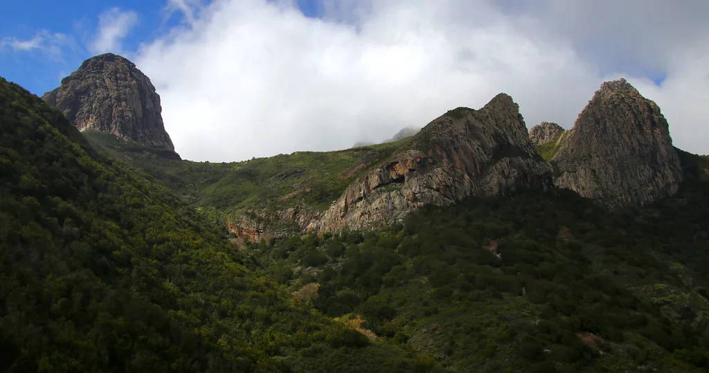
Fog is the main risk. Cloud often sits on La Gomera's central ridge, and it can wipe out the rock completely. Look at the forecast before you drive up, and do not set out blind. No source here confirms whether morning or afternoon is clearer, so judge by the day's conditions rather than the clock. If the roque is hidden, switch to Bosque del Cedro, about 2.1 km away, where laurel forest and a year-round stream work well in mist. Return later in the day if the cloud lifts.
Costs, hours and time needed
There is no admission fee, and the viewpoints are open-air with no opening hours. Budget 15–30 minutes. That is enough for photos and a read of the landscape. Parking at Mirador del Morro de Agando is available without any listed charge.
- Mistake: driving up without checking cloud cover
- Mistake: expecting a summit hike
- Mistake: leaving the marked paths or leaving litter behind
- Mistake: planning a long detour for this stop alone
What to combine with Roque de Agando
Build a half-day loop around the viewpoint and Garajonay stops. Start at the roque, then move to the forest and the recreation area. Distances below are approximate and measured from the rock.
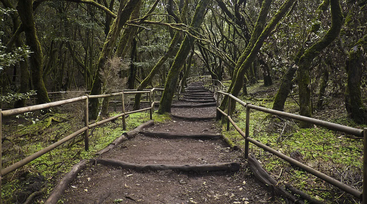
- Bosque del Cedro, about 2.1 km: laurel forest, a year-round stream and a hermitage on signed Garajonay routes
- Silbo Gomero monument at the Igualero viewpoint, about 4.1 km: the island's whistled language
- Laguna Grande, about 4.6 km: the largest recreation area in Garajonay, with picnic spots
- Parque Etnográfico, about 5.1 km: a farm museum with a gofio mill and looms
- Restaurante La Fortaleza, about 6 km, and Restaurante Roque Blanco, about 7.4 km, for local food
Why it exists: a quick geology and Guanche note
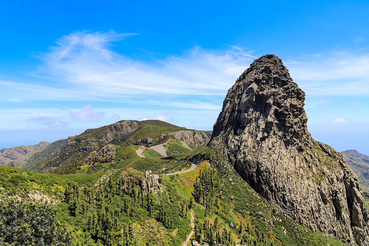
A volcanic plug forms when magma hardens inside a volcano's vent. Erosion then strips away the softer cone and leaves the hard core standing. La Gomera's tourism site describes Agando as an old volcanic conduit exposed over millions of years. That makes it the old, eroded end of the volcanic spectrum. Young landscapes look very different, as in the submarine eruption described in our Tagoro volcano guide. To place La Gomera among the other islands, use the Canary Islands Volcano Map: Where the Volcanoes Are. For monitoring and background science, see the Instituto Volcanológico de Canarias. The name is of Guanche origin, and local guides say it means "crest". Guanche remains were reportedly found on the summit and later damaged.
At 1,246 m, the plug is the hard core left after erosion stripped away the softer cone around it.
Frequently Asked Questions
What is the highest point of La Gomera?
Roque de Agando is the island's best-known landmark, but it is not the highest point. That title belongs to Alto de Garajonay, inside Garajonay National Park.
Where is the island La Gomera?
La Gomera is one of the Canary Islands, an archipelago belonging to Spain. Roque de Agando stands in the island's centre, beside Garajonay National Park.