Plomb du Cantal: Hiking Routes, Difficulty & Access
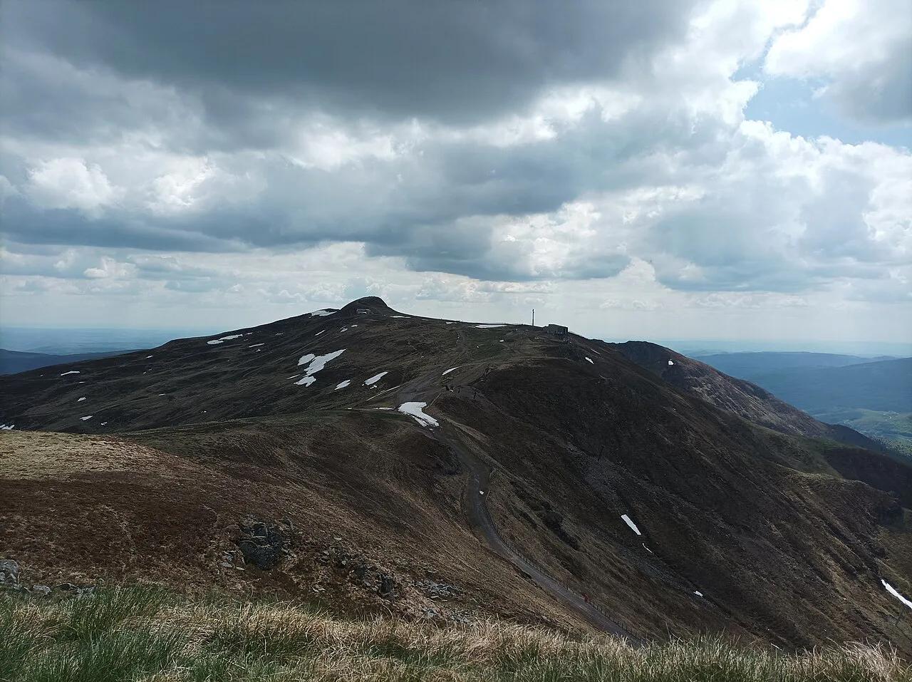
Last updated November 2026: the Plomb du Cantal is the highest summit of the Cantal volcano, at 1,855 m (6,086 ft). Its easiest ascent starts at Col de Prat-de-Bouc and covers 4.88 miles in about 3h35. Looking for the Paris restaurant of the same name? This guide covers the mountain.
Featured image: Nouill, CC BY-SA 4.0, via Wikimedia Commons.
Plomb du Cantal at a glance
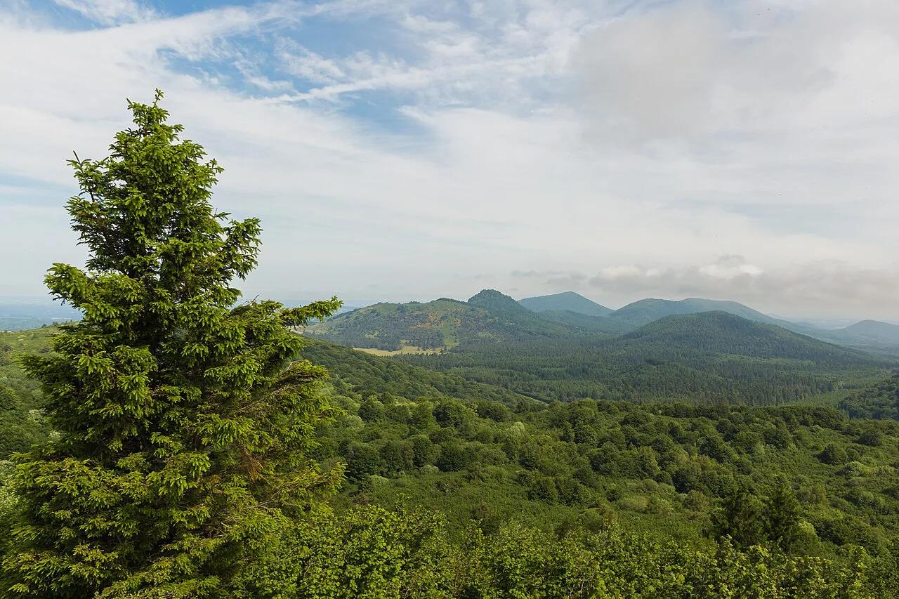
Plomb du Cantal crowns the Cantal volcanic massif, which Visorando describes as the largest volcanic complex in Europe. Its summit stands at 1,855 m, although one route listing gives 1,856 m. Views reach north to the Monts-Dore around Puy de Sancy Guide: Routes, Season & Cable Car, and south to the Cézallier and Aubrac plateaus. Puy de Sancy rises slightly higher, so this is not the top peak of the Massif Central. Cantal is a separate massif from the Chaîne des Puys, lying south of it. Le Lioran is the nearest resort hub.
- Height: 1,855 m (6,086 ft)
- Massif: Cantal volcano, Monts du Cantal, Auvergne
- Nearest hub: Le Lioran and Super Lioran
- Shortest climb: Col de Prat-de-Bouc, 4.88 miles round trip, +1,535 ft
- Lift option: cable car from Le Lioran to the ridge
Which Plomb du Cantal route should you choose?
Six routes cover most plans. Distances, climbs and times come from user-submitted Visorando tracks, so treat them as planning estimates and check the map before you leave. Pick the Prat-de-Bouc route if you are short on time. Choose the Super Lioran route if you want to avoid the lifts. Take the one-way descent if you plan to ride the cable car up.
| Route | Start | Distance | Ascent | Time | Difficulty | Best for |
|---|---|---|---|---|---|---|
| From Col de Prat-de-Bouc | Albepierre-Bredons | 4.88 mi | +1,535 ft | 3h35 | Moderate | Shortest climb |
| From Super Lioran via GR4 | Laveissière | 6.26 mi | +2,251 ft | 4h50 | Difficult | Climbing without the ski slopes |
| Loop around the Plomb | Col de Prat-de-Bouc | 8.85 mi | +3,061 ft | 6h45 | Difficult | Full day with Puy du Rocher |
| Prés Marty and ridge | Albepierre-Bredons | 12.14 mi | +2,549 ft | 7h50 | Moderate | Quiet pastures, off-season |
| Les Gardes, return via Ferval | Saint-Jacques-des-Blats | 8.96 mi | +2,884 ft | 6h40 | Difficult | Steady climb, valley return |
| Plomb to Lioran via Puy du Rocher | Saint-Jacques-des-Blats (listed) | 4.08 mi | +404 ft, -2,205 ft | 2h15 | Moderate | One-way trip with the lift |
Easiest route: Col de Prat-de-Bouc
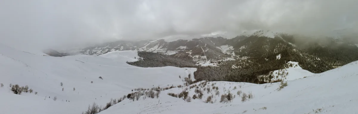
Col de Prat-de-Bouc gives the shortest way up. The listed route starts from Albepierre-Bredons and covers 4.88 miles with 1,535 ft of climbing. Budget about 3h35 for the full round trip. Visorando rates it moderate, so it suits fit walkers more than strict beginners. Children who are used to hill walking can manage it with breaks. Start early in summer to keep the summit clear of afternoon cloud. Pack a windproof layer, because the top is a bare ridge.
From Le Lioran and the cable car
Le Lioran offers two choices. Walking from the resort is the harder option. The Super Lioran route covers 6.26 miles with 2,251 ft of climbing and takes about 4h50. It follows the GR4 and avoids climbing the ski slopes. Visorando warns that the IGN map shows the GR4 on the Alpins slope, while the marked path now runs further east. Follow the current waymarks, not the printed map line. The lift route saves most of the climb. Ride the cable car up, then walk the 4.08-mile ridge route down via Puy du Rocher in about 2h15. That route climbs just 404 ft and drops 2,205 ft. After Puy du Rocher, two rock sections need hands, and aids are fitted. Operating dates and fares change by season. Check them on the official Le Lioran site before you plan around the lift.
Walking up from Le Lioran means 2,251 ft of climbing, compared with 1,535 ft from Col de Prat-de-Bouc.
Longer loops and ridge walks
A full day suits the loop around the Plomb. It covers 8.85 miles with 3,061 ft of climbing and takes about 6h45. It starts at Col de Prat-de-Bouc, climbs the summit, drops on the northern slope, then crosses Puy du Rocher. Quieter days belong to the Prés Marty route. It runs 12.14 miles in about 7h50 and crosses summer pastures before the ridge. Visorando suggests it outside the season, when the Lioran chairlifts are not running. Les Gardes offers a third option. It starts at Saint-Jacques-des-Blats, covers 8.96 miles in about 6h40, and returns through the Ferval valley. Multi-day walkers can link the peak into the Tour du Cantal, which runs 7 days over 53.24 miles. The full GR400 circuit takes 8 days over 88.49 miles.
Best time to go, weather and safety
Late spring to autumn is the walking season, and snow decides the exact window. The summit is a ridge, so wind and cloud arrive without warning. Check a mountain forecast on the morning you go. Cows graze the pastures from May to autumn, particularly on the Les Gardes and Ferval route. Keep your distance and close gates. Two checks prevent most mistakes. Confirm the GR4 line near the Alpins slope, and allow 6 to 8 hours for the long loops. Starting after midday is the usual error on those days. Winter turns the peak into a ski-touring objective, with a listed route of 6.29 miles from Prat de Bouc to Le Lioran. That is for people with avalanche training and equipment, not casual walkers.
Allow 6 to 8 hours on the long loops, well beyond the 3h35 budgeted for the shortest Prat-de-Bouc climb.
- Mistake to avoid: following the printed GR4 line onto the Alpins ski slope
- Mistake to avoid: starting a 6h45 loop late in the day
- Mistake to avoid: assuming the lifts run in the shoulder season
- Rock descent: two sections after Puy du Rocher need care in wet weather
Getting there and parking
Four access points matter. Albepierre-Bredons serves Col de Prat-de-Bouc. Laveissière serves the Super Lioran route. Saint-Jacques-des-Blats serves Les Gardes and the one-way ridge walk. Le Lioran is the resort base for the cable car. Most walkers arrive by car. Parking rules, winter road status and any bus service to Le Lioran or Prat de Bouc are not confirmed here. Check the Le Lioran official site for current access and the nearest rail connection.
Where to stay and eat nearby
Le Lioran and Super Lioran are the practical bases for the cable car and the Super Lioran route. Murat is the listed start of the 8-day GR400 circuit. Thiézac is where GR400 stage 2 ends, after 11.90 miles from Prat de Bouc. Cantal cheese is the regional product to look for in local shops and cafés. Browse the Le Lioran site for current lodging and opening times.
Combine it with other volcano stops
Within the Cantal massif, Puy Mary Guide: Summit Hike, Routes & Planning is the closest volcano stop for a second day. For the wider picture, start with our guide to volcanoes in France. Readers who want the best-known cones should look north to Puy de Dôme. Geology and protected-area rules for the region sit with the Parc naturel régional des Volcans d'Auvergne. Check drive times on a current map, because they depend on the road and season.
Why Plomb du Cantal Feels Different from the Chaîne des Puys
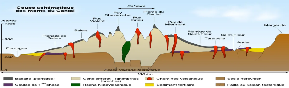
Plomb du Cantal is part of the Cantal volcanic massif, not the Chaîne des Puys. The Cantal landscape is the eroded remnant of a large volcanic complex, with ridges and valleys replacing the neat cone shapes many visitors expect in Auvergne.
At 1,855 m, the summit is a broad, high ridge rather than an isolated volcanic cone. That setting explains why weather matters so much. Cloud can obscure the views, and wind can be much stronger above the sheltered valleys.
The difference also shapes the walk. The shortest return route from Col de Prat-de-Bouc is 4.88 miles, but it still gains 1,535 ft before reaching the summit. For a longer ridge experience, the loop via Puy du Rocher covers 8.85 miles and takes about 6h45.
Visitors interested in the better-known volcanic cones can explore the Chaîne des Puys separately. Plomb du Cantal is better approached as a mountain hike through the southern volcanic highlands, with wide pastureland and long ridge views.